How To Enter Latitude And Longitude

Imagine standing at the edge of the Grand Canyon, the vast expanse stretching before you like a painted masterpiece. You want to share this exact, breathtaking view with a friend, down to the very inch of where you stood. How do you pinpoint this specific spot on a planet so vast?
Understanding how to input latitude and longitude coordinates unlocks a powerful tool for navigation, exploration, and precise communication of locations. This article provides a clear, step-by-step guide to entering these coordinates correctly across various platforms, empowering you to share and find locations with accuracy.
The Language of Location
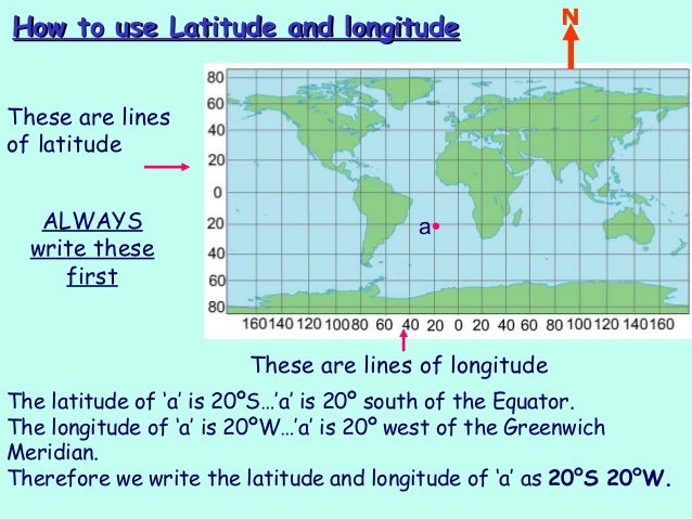
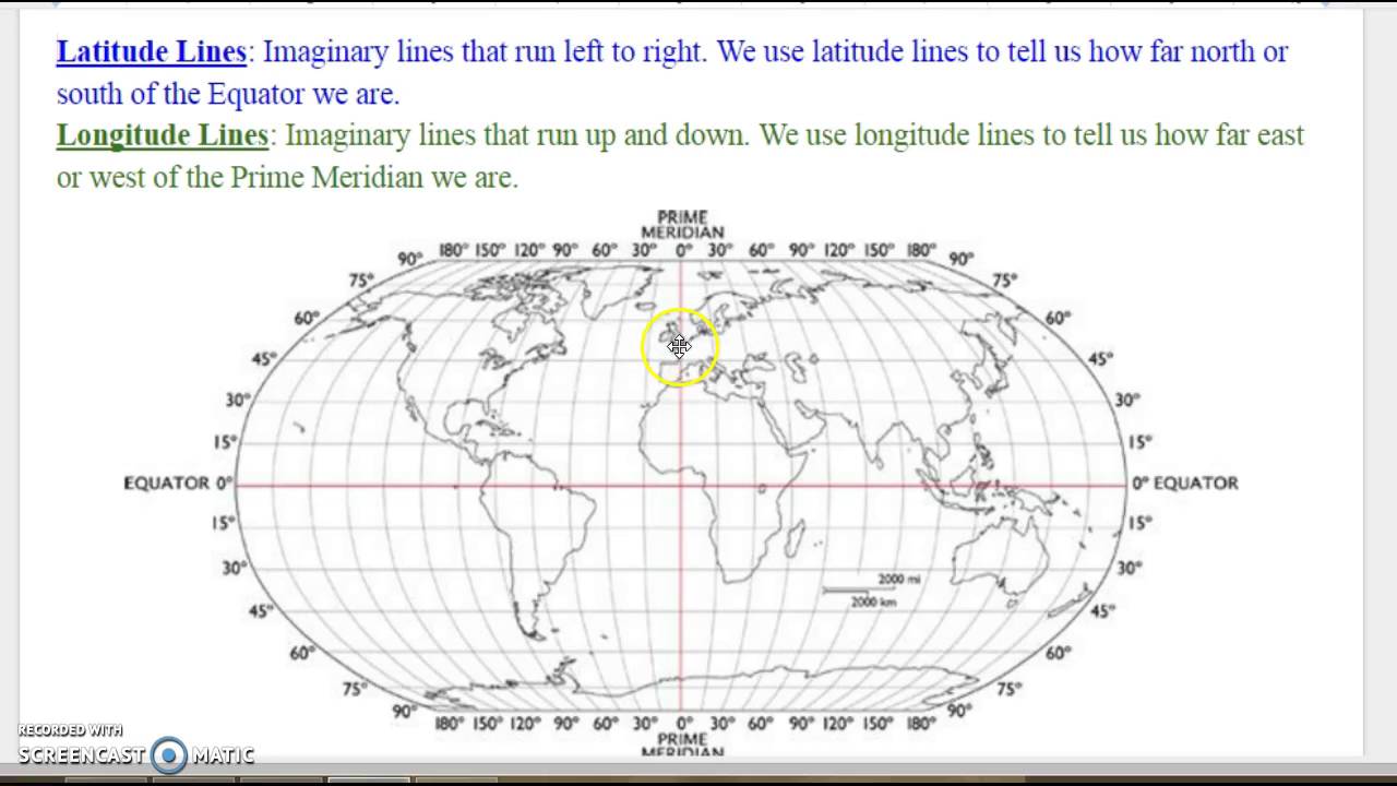
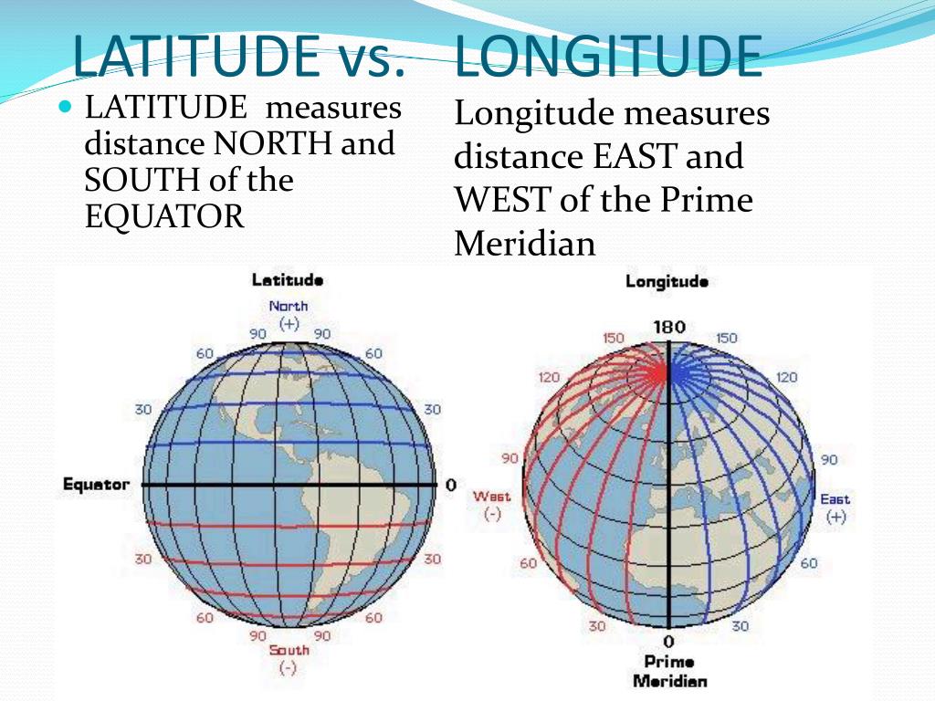
Latitude and longitude are the fundamental components of the geographic coordinate system, a global grid that allows us to pinpoint any location on Earth. Think of it as the Earth’s address system. Latitude measures the angular distance, in degrees, north or south of the equator, which is 0 degrees.
The North Pole is 90 degrees North (90° N), while the South Pole is 90 degrees South (90° S). Longitude, on the other hand, measures the angular distance east or west of the Prime Meridian, an imaginary line that runs through Greenwich, England, also at 0 degrees.
Longitude ranges from 0 to 180 degrees East (180° E) and 0 to 180 degrees West (180° W). It’s important to note that the 180th meridian serves as both 180° E and 180° W.
Decoding the Formats
Latitude and longitude coordinates can be expressed in several formats, each with its own conventions. The most common formats are Decimal Degrees (DD), Degrees Minutes Seconds (DMS), and Degrees Decimal Minutes (DMM).
Decimal Degrees (DD) is the simplest format, where both latitude and longitude are expressed as decimal numbers. For example, the coordinates for the Eiffel Tower in Paris might be represented as 48.8584° N, 2.2945° E.
Degrees Minutes Seconds (DMS) breaks down the degrees into minutes and seconds. Each degree is divided into 60 minutes, and each minute is divided into 60 seconds. A DMS coordinate might look like this: 48° 51' 31" N, 2° 17' 40" E.
Degrees Decimal Minutes (DMM) is a hybrid format that combines degrees with decimal minutes. It would look something like this: 48° 51.504' N, 2° 17.472' E.
Entering Coordinates on Different Platforms
The method for entering latitude and longitude varies depending on the platform or device you're using. Here are a few examples:
Google Maps
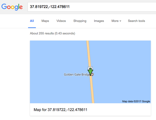
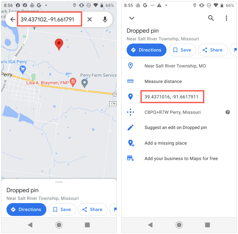
Google Maps accepts coordinates in all three formats. You can simply type the coordinates into the search bar. Make sure to separate the latitude and longitude with a comma.
For example, entering "48.8584, 2.2945" will take you directly to the Eiffel Tower. Google Maps automatically recognizes whether you are entering decimal degrees, DMS, or DMM based on the presence of symbols like °, ', and ".
GPS Devices
Most GPS devices, like those found in cars or handheld units, have specific fields for entering latitude and longitude. You will usually find separate boxes for degrees, minutes, and seconds, or decimal degrees. Refer to your device's manual for precise instructions.
Online Mapping Tools
Many online mapping tools, besides Google Maps, support coordinate input. The interface may vary, but typically there's a search box or a dedicated section for entering latitude and longitude. Some platforms may require you to specify the format (DD, DMS, or DMM) before entering the coordinates.
Common Mistakes to Avoid
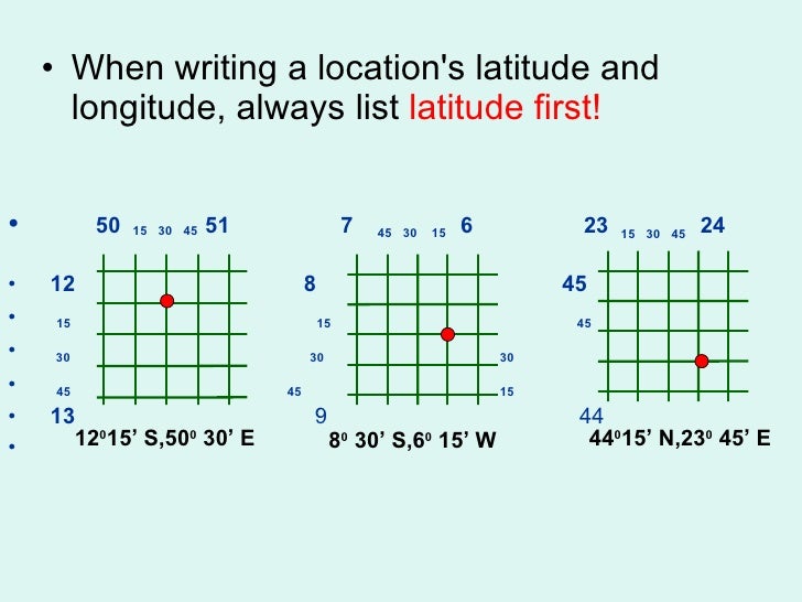
Accuracy is paramount when working with geographic coordinates. A small error can result in a significant location discrepancy. A common mistake is mixing up latitude and longitude or entering them in the wrong order.
Always double-check that you’re entering the latitude first, followed by the longitude. Pay close attention to the N/S and E/W designations. For example, entering "85.0 N" instead of "85.0 S" will place you on the opposite side of the Earth.
When entering decimal degrees, remember that South latitudes and West longitudes are represented as negative numbers. For instance, the coordinates for a location in South America might have a negative latitude value.
The Power of Precision
The ability to accurately input and interpret latitude and longitude empowers a wide range of activities. From navigating unfamiliar terrain to sharing memorable locations with friends, this seemingly simple skill opens doors to a world of possibilities. NASA relies on this information for space explorations.
Whether you're a seasoned adventurer or a curious explorer, mastering latitude and longitude is like unlocking a secret code to the planet. It’s a language understood by GPS devices, mapping software, and anyone who seeks to navigate the world with precision.
So, the next time you find yourself captivated by a stunning vista or want to share a hidden gem, remember the power of latitude and longitude. Input those coordinates with confidence, and watch as the world unfolds before you, one precise location at a time.