Size Of Africa Vs North America
A common cartographic misconception dramatically underestimates the true size of Africa, leading to a distorted global perspective.
This article aims to rectify this misunderstanding by presenting definitive data comparing the landmasses of Africa and North America.
The Misleading Map
The Mercator projection, a widely used map projection, significantly distorts the relative sizes of landmasses, especially those far from the equator.
This distortion creates a visual misrepresentation, making Africa appear much smaller than it actually is.
Consequently, many people are unaware of the continent's immense scale.
Africa: A Colossal Continent
The actual area of Africa is approximately 30.37 million square kilometers (11.7 million square miles).
This vast area encompasses a diverse range of climates, ecosystems, and cultures.
It represents about 20% of the Earth's total land area.
North America: A Significant Landmass, But Smaller Than You Think
North America, while substantial in size, measures approximately 24.23 million square kilometers (9.36 million square miles).
This includes the areas of Canada, the United States, Mexico, Central America, and the Caribbean.
Despite its vastness, it is demonstrably smaller than the African continent.
Head-to-Head Comparison: The Numbers Don't Lie
Africa is significantly larger than North America, exceeding it by roughly 6.14 million square kilometers (2.34 million square miles).
To put this in perspective, the difference in area is almost the size of Australia.
This substantial difference highlights the extent of the distortion caused by map projections like the Mercator.
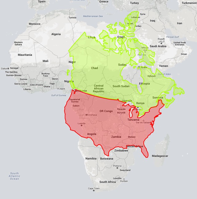
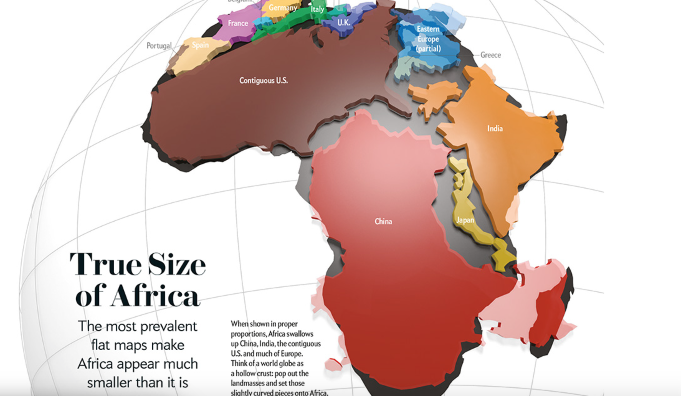
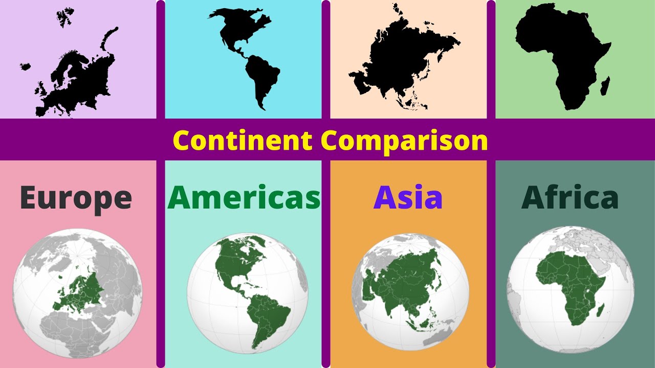
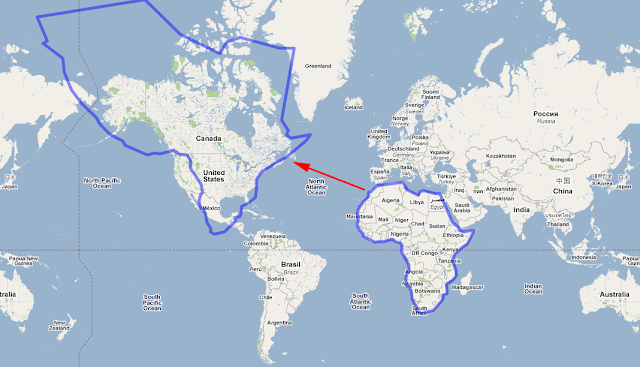
Visualizing the Difference
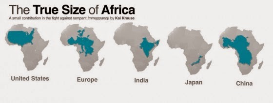
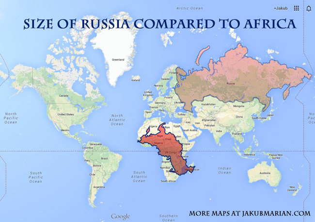
Several sources illustrate the true size of Africa by overlaying it with other countries and continents.
For example, one widely circulated graphic shows that you can fit the United States, China, India, and much of Europe inside Africa.
These visual aids are crucial in combating the prevailing misperception.
The Consequences of Misrepresentation
The underestimation of Africa's size can influence perceptions about its importance, resources, and potential.
It can also perpetuate inaccurate assumptions about its population distribution and development challenges.
Accurate representations are vital for fostering informed global understanding.
Data Sources and Verification
The land area figures presented are based on data from reputable sources such as the United Nations Statistics Division and the World Bank.
These organizations provide standardized and globally recognized data on land area measurements.
Independent verification through multiple sources confirms the accuracy of these figures.
Moving Forward: Promoting Accurate Cartography
Efforts are underway to promote the use of map projections that more accurately represent the relative sizes of landmasses.
The Gall-Peters projection, for example, prioritizes area accuracy over shape accuracy.
Educational initiatives are also crucial in raising awareness and correcting misconceptions.
Ongoing Developments
Geographers and educators are continuously working to refine map projections and improve the accuracy of global representations.
The increasing availability of digital mapping tools and resources facilitates access to accurate geographical information.
Ongoing research and educational campaigns are essential to challenge ingrained misconceptions and promote a more accurate understanding of the world.