How Does Cemetery Management Software Handle Mapping

The hallowed grounds of cemeteries, often perceived as serene and timeless, are undergoing a quiet technological revolution. Forget the image of dusty ledgers and hand-drawn maps; modern cemetery management is increasingly reliant on sophisticated software to navigate and manage these sprawling landscapes. The core of this transformation lies in advanced mapping capabilities, streamlining operations and enhancing the experience for both staff and grieving families.
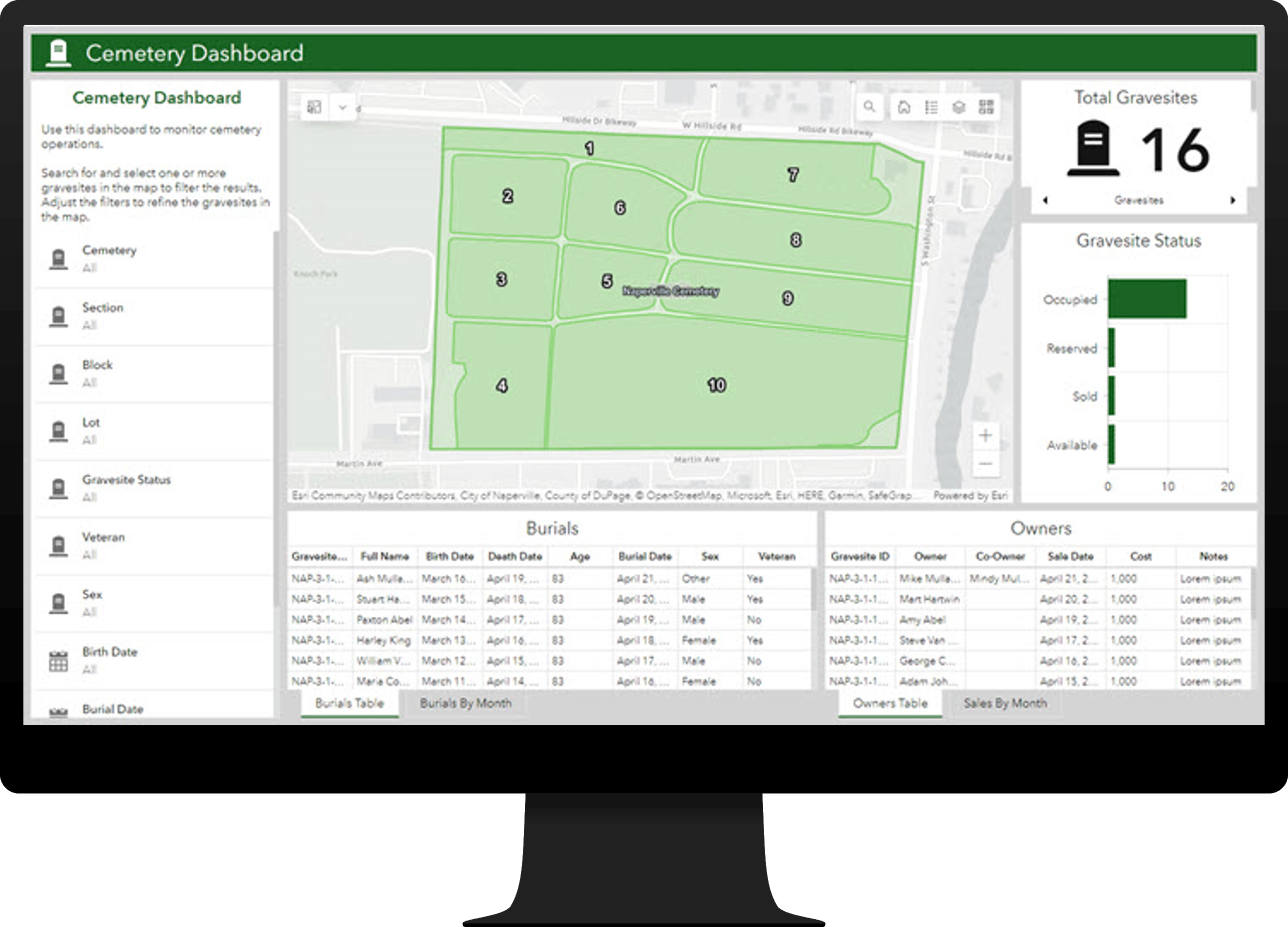
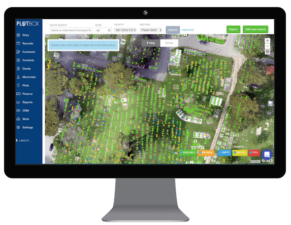
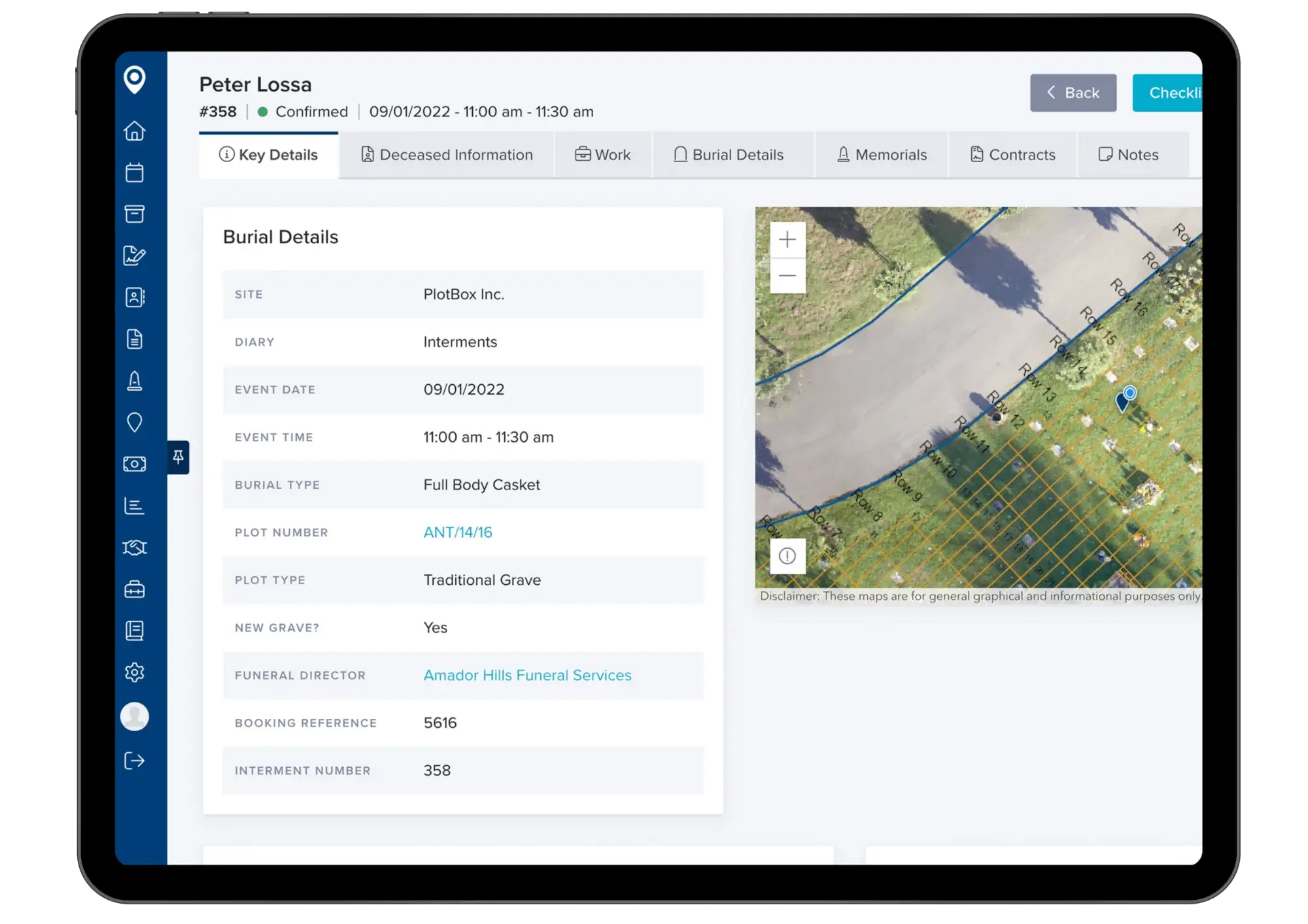
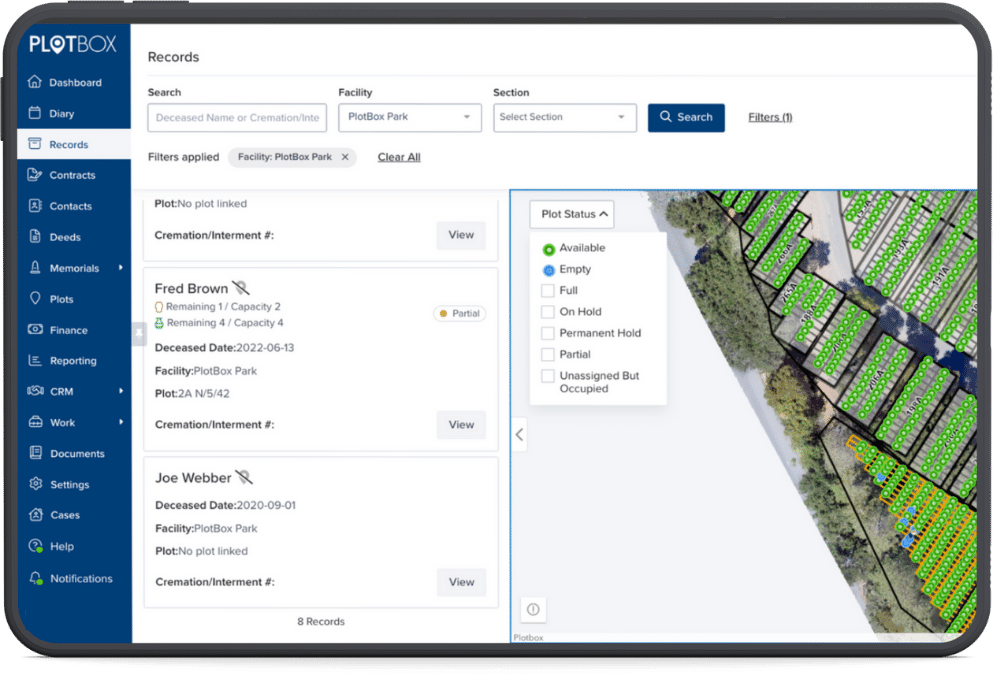
At the heart of this shift is cemetery management software, a suite of tools designed to handle everything from burial records and plot sales to maintenance schedules and genealogical inquiries. But one feature stands out: its mapping functionality. This capability not only creates a digital representation of the cemetery but also integrates with various data points, creating an interactive and informative resource.
The Nuts and Bolts of Digital Mapping
Cemetery mapping software employs a variety of technologies to create accurate and dynamic digital representations. These methods range from traditional surveying techniques to cutting-edge geospatial technologies.
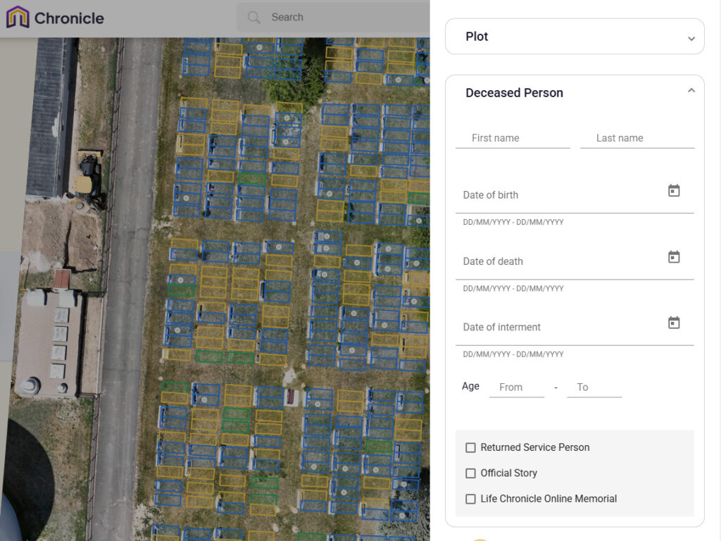
One common approach involves GIS (Geographic Information Systems). GIS allows cemeteries to overlay spatial data with other information, such as burial records, ownership details, and even photographs of headstones. This integration creates a rich, searchable database accessible to staff and, in some cases, the public.
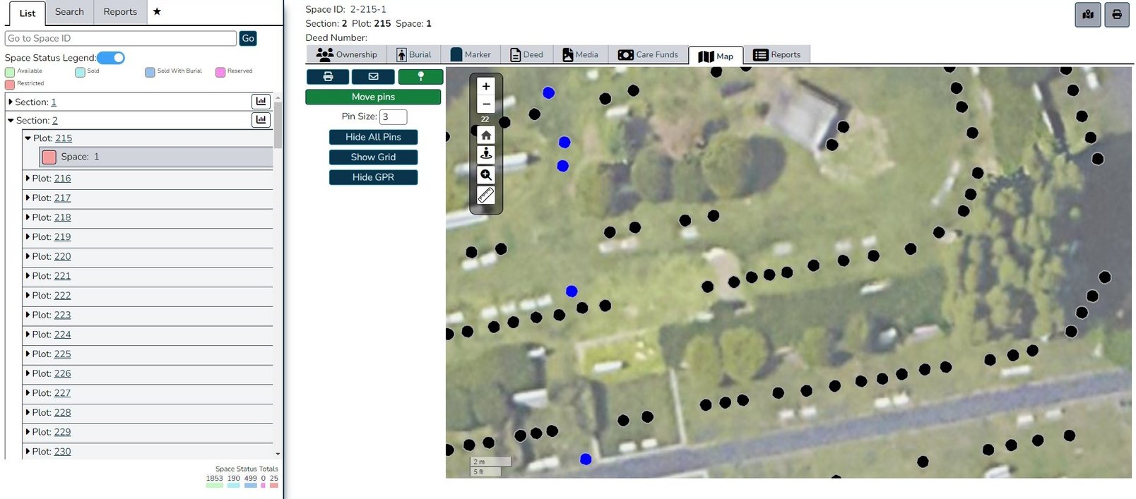
Increasingly, cemeteries are utilizing GPS (Global Positioning System) technology for precise location data. Teams walk the grounds with GPS-enabled devices to record the coordinates of each plot, headstone, and feature. This data is then uploaded into the cemetery management software, creating a highly accurate map.
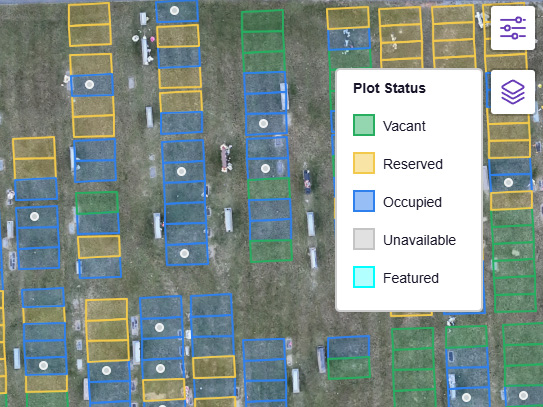
Another emerging technology is drone-based mapping. Drones equipped with high-resolution cameras capture aerial imagery, which is then processed using photogrammetry software to create 3D models of the cemetery. This provides a comprehensive and visually rich representation that can be used for planning, maintenance, and security purposes.
How Mapping Enhances Cemetery Management
The benefits of integrating mapping into cemetery management are multifaceted. It streamlines several key operations, improving efficiency and accuracy across the board.
One of the most significant advantages is improved record-keeping. No longer reliant on paper maps and handwritten notes, staff can quickly locate burial plots, verify ownership, and access historical records with a few clicks. This reduces the risk of errors and saves valuable time.
Mapping also simplifies plot sales. Sales staff can use the software to show potential buyers available plots, highlight their location within the cemetery, and even display pre-need arrangements. This interactive experience enhances the sales process and provides customers with greater control over their choices.
Maintenance and landscaping are also streamlined through accurate mapping. Staff can use the software to plan mowing routes, identify areas needing repair, and track the location of irrigation systems. This ensures efficient resource allocation and helps maintain the cemetery's aesthetic appeal.
Furthermore, mapping plays a crucial role in genealogical research. Many cemeteries are making their maps and burial records available online, allowing family members to easily locate the final resting places of their ancestors. This provides a valuable service to the community and preserves historical information.
Addressing Challenges and Considerations
While cemetery mapping software offers numerous benefits, there are also challenges to consider. The initial investment in software, hardware, and training can be significant. Data migration from existing paper records to a digital format can also be a time-consuming and labor-intensive process.
Maintaining data accuracy is paramount. As cemeteries evolve and new burials take place, it's essential to regularly update the map to reflect these changes. This requires ongoing effort and attention to detail.
Another consideration is privacy. Cemeteries must ensure that sensitive information, such as personal details of deceased individuals, is protected and handled in accordance with privacy regulations. Access to online maps and burial records should be carefully controlled to prevent misuse.
According to the International Cemetery, Cremation and Funeral Association (ICCFA), cybersecurity is a growing concern. Cemetery management software stores vast amounts of sensitive data, making it a potential target for cyberattacks. Cemeteries must implement robust security measures to protect their systems and data.
Looking Ahead: The Future of Cemetery Mapping
The future of cemetery mapping is likely to be shaped by advancements in technology and evolving user expectations. Artificial intelligence (AI) and machine learning (ML) could play a role in automating tasks such as identifying unmarked graves, detecting damage to headstones, and predicting future burial needs.
Augmented reality (AR) could also enhance the visitor experience. Imagine using a smartphone or tablet to scan a headstone and instantly access information about the deceased, including their biography, family history, and even photos and videos. This could transform cemeteries into interactive historical sites.
Furthermore, integration with other technologies, such as smart sensors and IoT devices, could enable real-time monitoring of cemetery conditions. Sensors could track soil moisture levels, temperature, and other environmental factors, providing valuable data for optimizing irrigation and maintenance practices.
As technology continues to evolve, cemetery mapping software will undoubtedly become even more sophisticated and essential for managing these important cultural and historical landscapes. By embracing these advancements, cemeteries can improve efficiency, enhance the visitor experience, and preserve the memories of those who have passed.